← Back to Search Results

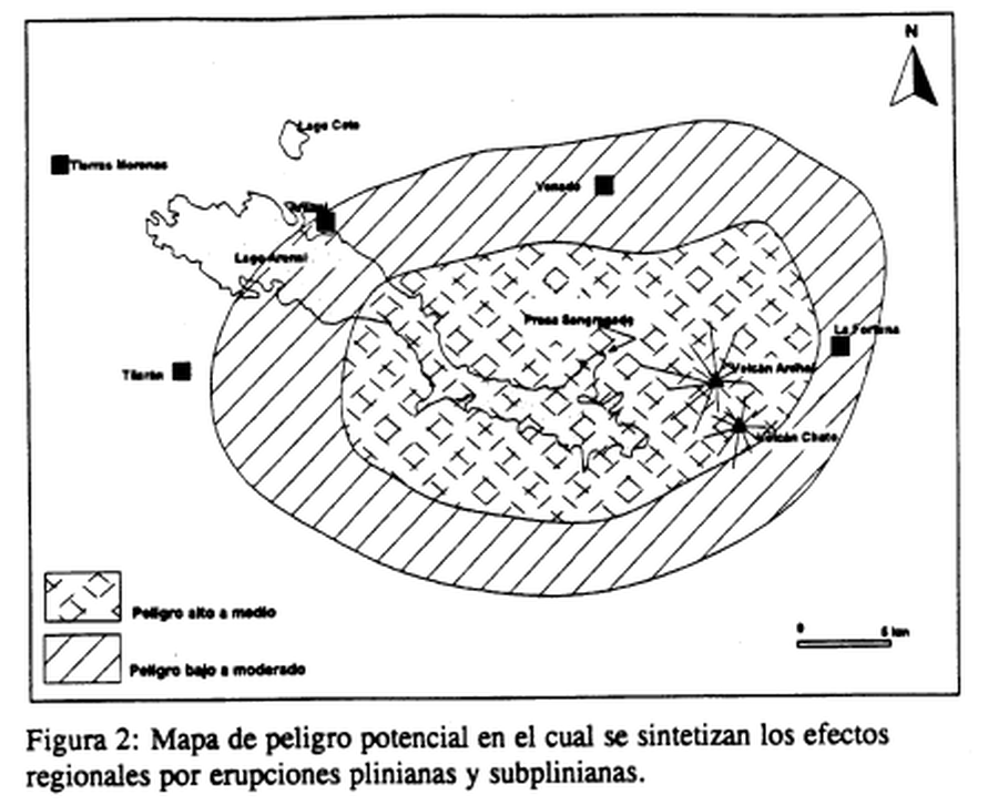
Mapa de peligro potencial en el cual se sintetizan los efectos regionales por erupciones plinianas y subplinianas

Map of potential danger in which the regional effects of plinian and subplinian eruptions are synthesized

Arenal, Costa Rica, 1997

Figure 2 in: Alvarado, G.E., Soto, G.J., Ghigliotti, M., & Frullani, A. (1997). Peligro volcánico del Arenal. Boletín OSIVAM, 8(15-16), p. 62-82.


This map was produced by an official agency, but is NOT the most recent, most complete, or main operational map. For the current operational hazard map, please consult the proper institutional authorities.


Click on image for full-size map. If link seems broken, try the archived version.

Map Set

Alvarado, G.E., Soto, G.J., Ghigliotti, M., and Frullani, A. (1997). Peligro volcánico del Arenal. Boletín OSIVAM, 8(15-16), p. 62-82.
https://rsn.ucr.ac.cr/images/Biblioteca/Publicaciones_Periodicas/Boletines_OSIVAM/15_16_BoletinOSIVAM_08_Junio_1997.pdf

Other Maps In Set:

Map Data

Map ID3870
Hazard Process(es)Unstated or all hazards
Hazard Zone PresentationHazard level-focused: All or most hazards are combined by hazard level on a main map panel
Temporal ScaleBackground, or long-term, map
Spatial ScaleRegional
Publication FormatFigure in a hazard assessment or mitigation plan
Zonation Method(s)Geologic history
Zonation Model(s)
Scenario(s) ConsideredSize, VEI, or intensity
Hazard Zone Label(s)Qualitative relative probability (e.g. high-medium-low)
Probability Definition(s)Qualitative relative probability (e.g. high-medium-low)
PurposeLand-use planning: Intended to inform citing of facilities, building restrictions, resource management, and infrastructure development
AudienceLand-use planners, city planners, government officials, etc.
Language(s)Spanish
Basemap(s)Simple or sketch map
Basemap overlay(s)
DiemsionalityPlanimetric (2D or map) view
Color SchemeSymbols and/or lines only
Go to Global Volcanism Program page for Arenal →