
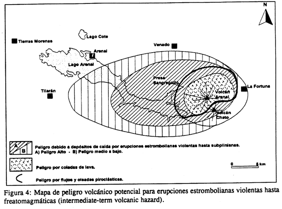
Mapa de peligro volcánico potencial para erupciones estrombolianas violentas hasta freatomagmáticas (intermediate-term volcanic hazard)
Potential volcanic hazard map for violent strombolian to phreatomagmatic (intermediate-term volcanic hazard) eruptions
Arenal, Costa Rica, 1997
Figure 4 in: Alvarado, G.E., Soto, G.J., Ghigliotti, M., & Frullani, A. (1997). Peligro volcánico del Arenal. Boletín OSIVAM, 8(15-16), p. 62-82.
This map was produced by an official agency, but is NOT the most recent, most complete, or main operational map.
For the current operational hazard map, please consult the proper institutional authorities.
Click on image for full-size map. If link seems broken, try the archived version.
Alvarado, G.E., Soto, G.J., Ghigliotti, M., and Frullani, A. (1997). Peligro volcánico del Arenal. Boletín OSIVAM, 8(15-16), p. 62-82. Map Set
https://rsn.ucr.ac.cr/images/Biblioteca/Publicaciones_Periodicas/Boletines_OSIVAM/15_16_BoletinOSIVAM_08_Junio_1997.pdf
Other Maps In Set: