
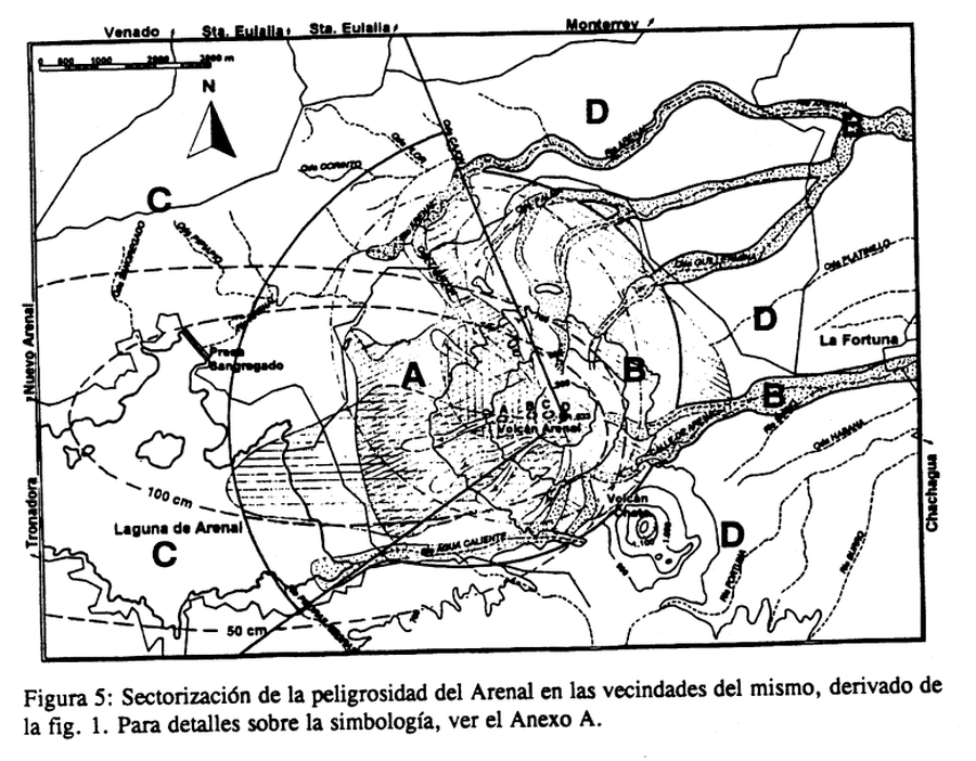
Sectorización de la peligrosidad del Arenal en las vecindades del mismo, derivado de la fig. 1
Sectorization of the danger of Arenal in its vicinity, derived from fig. 1
Arenal, Costa Rica, 1997
Figure 5 in: Alvarado, G.E., Soto, G.J., Ghigliotti, M., & Frullani, A. (1997). Peligro volcánico del Arenal. Boletín OSIVAM, 8(15-16), p. 62-82.
This map was produced by an official agency, but is NOT the most recent, most complete, or main operational map.
For the current operational hazard map, please consult the proper institutional authorities.
Click on image for full-size map. If link seems broken, try the archived version.
Alvarado, G.E., Soto, G.J., Ghigliotti, M., and Frullani, A. (1997). Peligro volcánico del Arenal. Boletín OSIVAM, 8(15-16), p. 62-82. Map Set
https://rsn.ucr.ac.cr/images/Biblioteca/Publicaciones_Periodicas/Boletines_OSIVAM/15_16_BoletinOSIVAM_08_Junio_1997.pdf
Other Maps In Set: