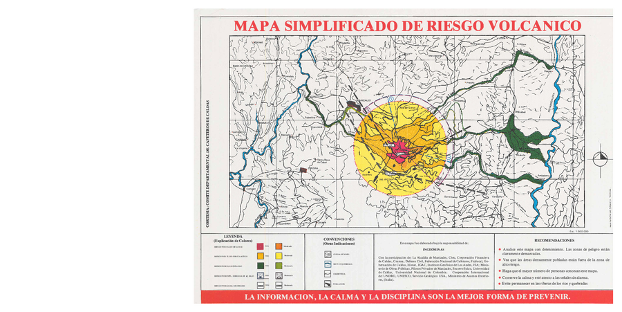
Mapa Simplificado de Riesgo Volcanico
Simplified Map of Volcanic Risk
Nevado del Ruiz, Colombia, 1985
Instituto Colombiano de Geología y Minería (INGEOMINAS). (1985?). Mapa Simplificado de Riesgo Volcanico. Comite Departmental de Cafeteros de Calda, Manizales.
This map was produced by an official agency, but is NOT the most recent, most complete, or main operational map.
For the current operational hazard map, please consult the proper institutional authorities.