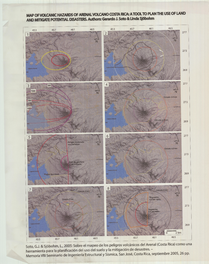
Map of Volcanic Hazards of Arenal Volcano Costa Rica: A Tool to Plan the Use of Land and Mitigate Potential Disasters
Arenal, Costa Rica, 2005
Soto, G.J. & Sjöbohm, L. (2005). Map of Volcanic Hazards of Arenal Volcano Costa Rica: A Tool to Plan the Use of Land and Mitigate Potential Disasters. (Modified from: Soto, G.J. & Sjöbohm, L. (2005). Sobre el mapeo de los peligros volcánicos del Arenal (Costa Rica) como una herramienta para la planificación del uso del suelo y la mitigación de desastres. Memoria VIII Seminario de Ingeniería Estructural y Sísmica, San José, Costa Rica, Septiembre 2005, 26 p.)
This map may not be the most recent, most complete, or main operational map.
For the current operational hazard map, please consult the proper institutional authorities.