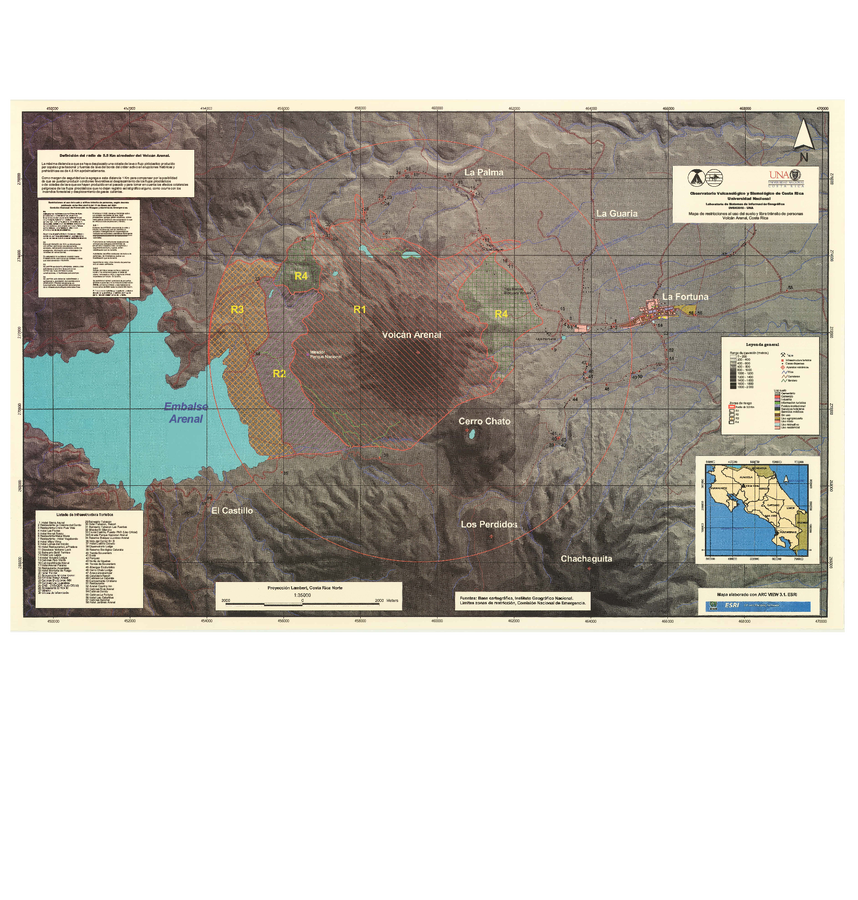
Mapa de restricciones al uso del suelo y libre transito de personas, Volcán Arenal, Costa Rica
Map of restrictions on land use and free movement of people, Arenal Volcano, Costa Rica
Arenal, Costa Rica, Year unknown
OVSICORI-UNA. (Year Unknown). Mapa de restricciones al uso del suelo y libre transito de personas, Volcán Arenal, Costa Rica. (Simplified from: Berrocal, M. and Malavassi, E. 2003)
This map was produced by an official agency, but may not be the most recent, most complete, or main operational map.
For the current operational hazard map, please consult the proper institutional authorities.