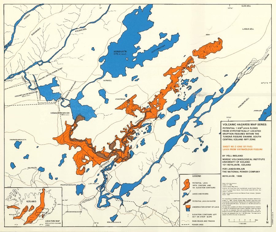
Potential 1 km³ Lava Flows From Hypothetically Located Eruption Fissures Within The Tungná Fissure Swarm, South Central Iceland Rift Zone
Vatnaöldur Fissure (Bárðarbunga), Iceland, 1988
Sheet 2 in: Imsland, P. (1988). Volcanic Hazard Map Series. Potential 1 km³ lava flows from hypothetically located eruption fissures within the Tungná Fissure Swarm, South Central Iceland Rift Zone (five sheets). 1:100,000. Nordic Volcanological Institute and National Power Company, Reykjavik. (Simplified from: Imsland. P., 1987. Volcanic Hazards Map: Potential Lawa Flows from hypothetically located Eruption Fissures within the Tungná Fissure Swarm. South Central Iceland Rift Zone. (six sheets in a 1:50,000 scale with 5 m contour interval).
This map was produced by an official agency, but is NOT the most recent, most complete, or main operational map.
For the current operational hazard map, please consult the proper institutional authorities.