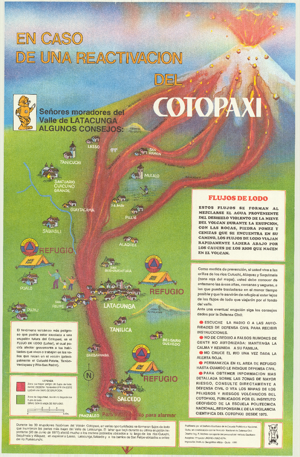
En Caso de Una Eventual Reactivacion del Volcan Cotopaxi
In Case of a Possible Reactivation of the Cotopaxi Volcano
Cotopaxi, Ecuador, 1991
Mothes, P. (1991). En Caso de Una Eventual Reactivacion del Volcan Cotopaxi. Instituto Geofísico de la Escuela Politecnica Nacional (IG-EPN) and Dirección Nacional de Defensa Civil, Quito.
This map was produced by an official agency, but is NOT the most recent, most complete, or main operational map.
For the current operational hazard map, please consult the proper institutional authorities.