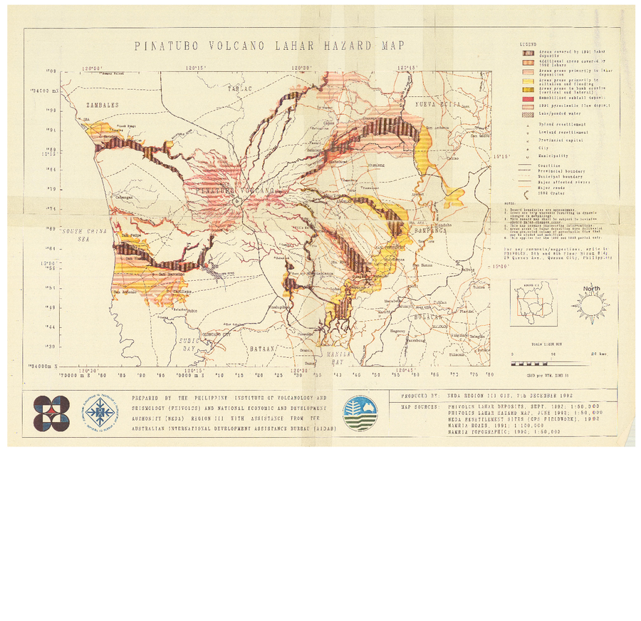
Pinatubo Volcano Lahar Hazard Map
Pinatubo, Philippines, 1992
Philippine Institute of Volcanology and Seismology (PHIVOLCS). (1992). Pinatubo Volcano Lahar Hazard Map. Philippine Institute of Volcanology and Seismology (PHIVOLCS), NEDA Region III GIS, Quezon City.
This map was produced by an official agency, but is NOT the most recent, most complete, or main operational map.
For the current operational hazard map, please consult the proper institutional authorities.