
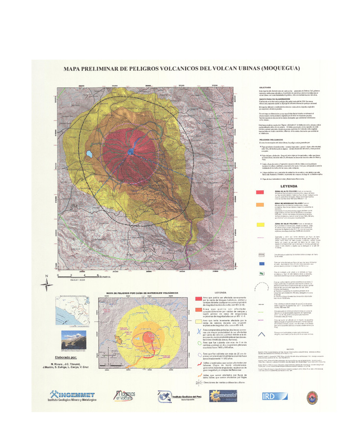
Mapa Preliminar de Peligros Volcanicos del Volcan Ubinas (Moquegua)
Preliminary Map of Volcanic Hazards of the Ubinas Volcano (Moquegua)
Ubinas, Peru, 2006
Rivera, M., Thouret, J.-C., Mariño, J., Zuñiga, S., Cacya, L., & Cruz V. (nd). Mapa Preliminar de Peligros Volcanicos del Volcan Ubinas (Moquegua). Instituto Geologico Minero y Metalurgico (INGEMMET), Laboratoire Magmas et Volcans, Instituto Geofísico del Perú, SENAMHI Medic, Institut de Recherche pour le Développement (IRD).
This map was produced by an official agency, but is NOT the most recent, most complete, or main operational map.
For the current operational hazard map, please consult the proper institutional authorities.
Map Set
Rivera, M., Mariño, J., Thouret, J.-C., Cacya, L., Cruz V., Zuñiga, S. (nd). Mapa Preliminar de Peligro Volcánico del Volcán Ubinas. XIII Congreso Peruano de Geología. Resúmenes Extendidos, Sociedad Geológica del Perú.
https://repositorio.ingemmet.gob.pe/bitstream/20.500.12544/3481/3/Rivera-Mapa_preliminar_peligro_volcanico_Ubinas.pdf
Other Maps In Set: