
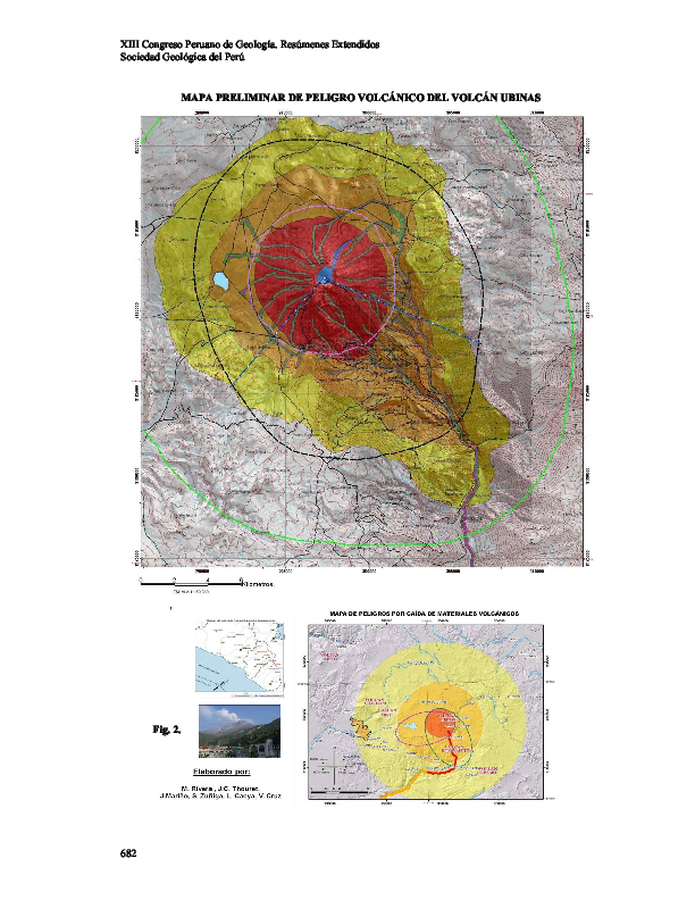
Mapa Preliminar de Peligro Volcánico del Volcán Ubinas
Preliminary Volcanic Hazard Map of Ubinas Volcano
Ubinas, Peru, 2006
Figure 2 in: Rivera, M., Mariño, J., Thouret, J.-C., Cacya, L., Cruz V., Zuñiga, S. (nd). Mapa Preliminar de Peligro Volcánico del Volcán Ubinas. XIII Congreso Peruano de Geología. Resúmenes Extendidos, Sociedad Geológica del Perú.
This map was produced by an official agency, but is NOT the most recent, most complete, or main operational map.
For the current operational hazard map, please consult the proper institutional authorities.
Click on image for full-size map. If link seems broken, try the archived version.
Rivera, M., Mariño, J., Thouret, J.-C., Cacya, L., Cruz V., Zuñiga, S. (nd). Mapa Preliminar de Peligro Volcánico del Volcán Ubinas. XIII Congreso Peruano de Geología. Resúmenes Extendidos, Sociedad Geológica del Perú.Map Set
https://repositorio.ingemmet.gob.pe/bitstream/20.500.12544/3481/3/Rivera-Mapa_preliminar_peligro_volcanico_Ubinas.pdf
Other Maps In Set: