
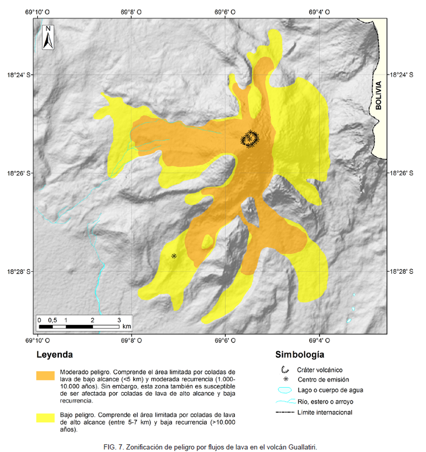
Zonificación de peligro por flujos de lava en el volcán Guallatiri
Hazard zoning for lava flows at Guallatiri volcano
Guallatiri, Chile, 2019
Figure 7 in: Jorquera, C., Rodríguez, I., Bertin, L., & Flores, F. (2019). Peligros del Volcán Guallatiri, región de Arica y Parinacota. Servicio Nacional de Geología y Minería (SERNAGEOMIN), Carta Geológica de Chile, Serie Geología Ambiental 35, 45 p., 1 mapa escala 1:50.000. Santiago.
This map was produced by an official agency, but may not be the most recent, most complete, or main operational map.
For the current operational hazard map, please consult the proper institutional authorities.
Map Set
Jorquera, C., Rodríguez, I., Bertin, L., & Flores, F. (2019). Peligros del Volcán Guallatiri, región de Arica y Parinacota. Servicio Nacional de Geología y Minería (SERNAGEOMIN), Carta Geológica de Chile, Serie Geología Ambiental 35, 45 p., 1 mapa escala 1:50.000. Santiago.
http://tienda.sernageomin.cl/TiendaVirtual2/ProductDetail.aspx?pid=2911
Other Maps In Set: