
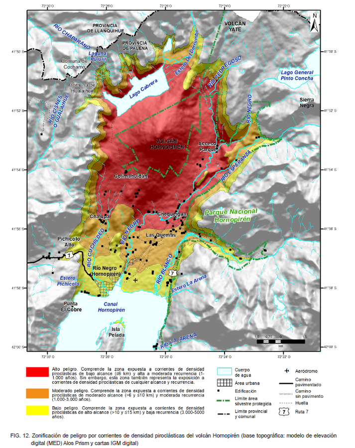
Zonificación de peligro por corrientes de densidad piroclásticas del volcán Hornopirén
Hazard zoning for pyroclastic density currents of the Hornopirén volcano
Hornopirén, Chile, 2021
Figure 12 in: Mella, M., Toloza, V., and Bertin, L. (2021). Peligros del volcán Hornopirén, región de Los Lagos. Servicio Nacional de Geología y Minería, Carta Geológica de Chile, Serie Geología Ambiental 37: 51 p., 1 mapa escala 1:50.000. Santiago.
This map was produced by an official agency, but may not be the most recent, most complete, or main operational map.
For the current operational hazard map, please consult the proper institutional authorities.
Map Set
Mella, M., Toloza, V., and Bertin, L. (2021). Peligros del volcán Hornopirén, región de Los Lagos. Servicio Nacional de Geología y Minería, Carta Geológica de Chile, Serie Geología Ambiental 37: 51 p., 1 mapa escala 1:50.000. Santiago.
http://tienda.sernageomin.cl/TiendaVirtual2/ProductDetail.aspx?pid=2969
Other Maps In Set: