
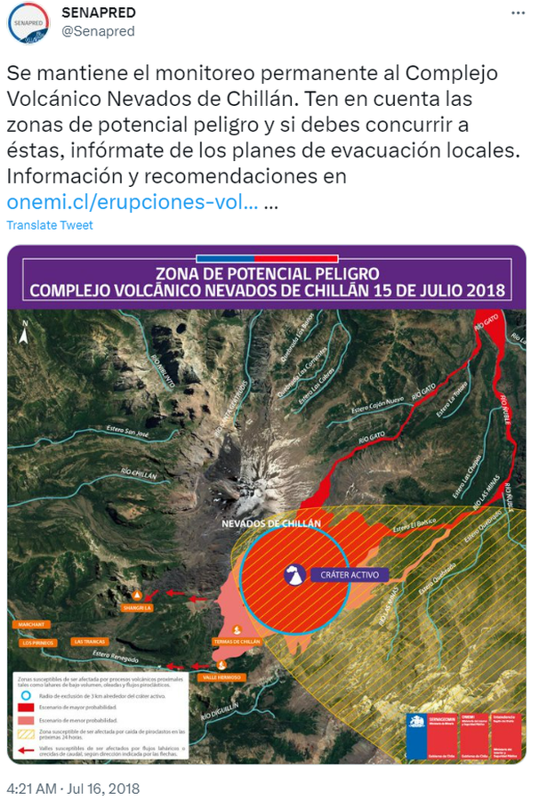
Zona de Potencial Peligro Complejo Volcánico Nevados de Chillán 15 de Julio 2018
Potential Hazard Zone Nevados de Chillán Volcanic Complex July 15, 2018
Nevados de Chillán, Chile, 2018
Servicio Nacional de Geología y Minería (SERNAGEOMIN) & Oficina Nacional de Emergencia del Ministerio del Interior y Seguridad Pública (ONEMI). (2018). Zona de Potencial Peligro Complejo Volcánico Nevados de Chillán 15 de Julio 2018. Twitter. https://twitter.com/Senapred/status/1018817975573450752
This map was produced by an official agency, but is NOT the most recent, most complete, or main operational map.
For the current operational hazard map, please consult the proper institutional authorities.
Click on image for full-size map.