
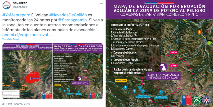
Mapa de Evacuación por Erupción, Volcánica Zona de Potencial Peligro - Comunas de San Fabián, Coihueco y Pinto
Volcanic Eruption Evacuation, Map Potential Hazard Zone - San Fabián, Coihueco and Pinto Communities
Nevados de Chillán, Chile, 2019
Servicio Nacional de Geología y Minería (SERNAGEOMIN) & Oficina Nacional de Emergencia del Ministerio del Interior y Seguridad Pública (ONEMI). (2019). Mapa de Evacuación por Erupción, Volcánica Zona de Potencial Peligro - Comunas de San Fabián, Coihueco y Pinto. Twitter. https://twitter.com/Senapred/status/1176617555206823941
This map was produced by an official agency, but is NOT the most recent, most complete, or main operational map.
For the current operational hazard map, please consult the proper institutional authorities.
Click on image for full-size map.