
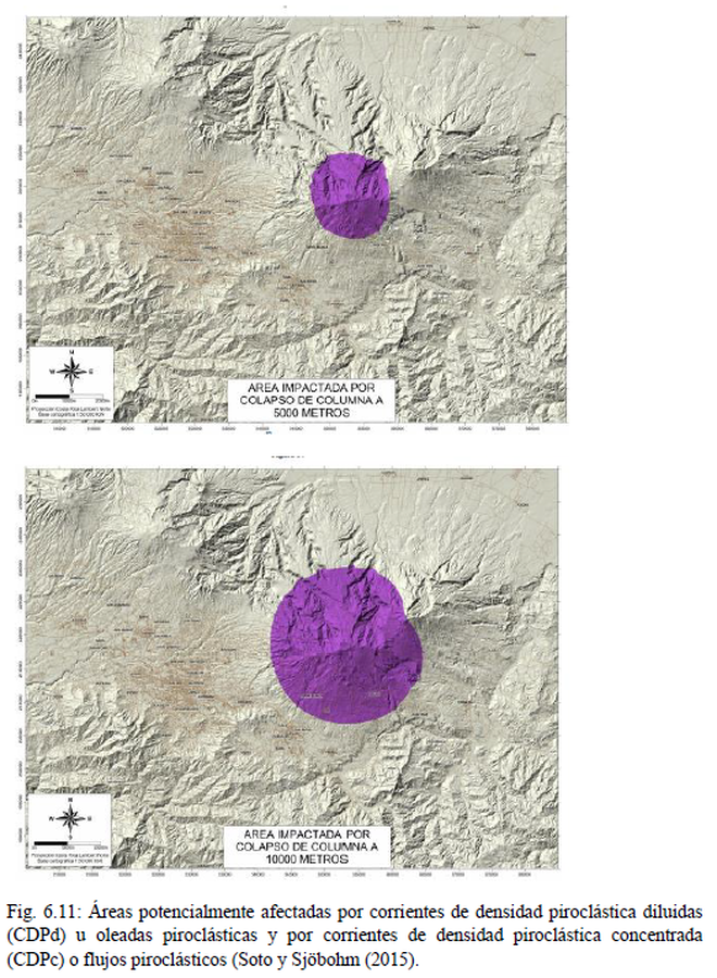
Area Impactada por Colapso de Columna
Area Impacted by Column Collapse
Irazú, Costa Rica, 2021
Figure 6.11 in: Alvarado, G.E., Campos-Durán, D., Brenes-André, J., Alpízar, Y., Núñez, S., Esquivel, L., Sibaja, J.P. & Fallas, B. (2021). Peligro Volcánico del Irazú, Costa Rica. Comisión Nacional de Prevención de Riesgos y Atención de Emergencias (CNE). Deciembre 2021. (Modified from: Soto & Sjöbohm 2015).
This map was produced by an official agency, but may not be the most recent, most complete, or main operational map.
For the current operational hazard map, please consult the proper institutional authorities.
Click on image for full-size map.
Map Set
Alvarado, G.E., Campos, D., Brenes-André, J., Alpízar, Y., Núñez, S., Esquivel, L., & Fallas, B. (2021). Peligro Volcánico del Irazú, Costa Rica. Comisión Nacional de Prevención de Riesgos y Atención de Emergencias (CNE). Septiembre 2021.
https://www.cne.go.cr/reduccion_riesgo/biblioteca/informes/Amenaza%20Volcanica%20Irazu%20CNE%208.9.%202021.pdf
Simplified, modified, or derived from:
- Area Impactada por Colapso de Columna a 5000 Metros
- Area Impactada por Colapso de Columna a 10000 Metros