
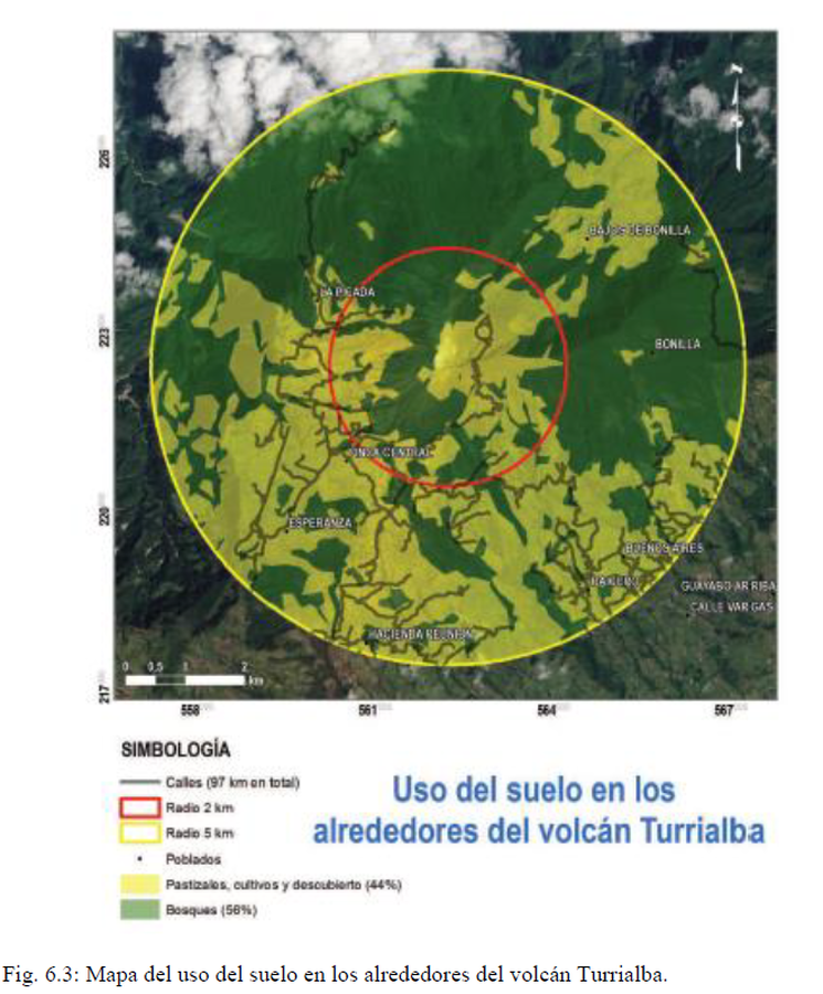
Uso del suelo en los alrededores del volcán Turrialba
Land use around the Turrialba volcano
Turrialba, Costa Rica, 2020
Figure 6.3 in: Alvarado, G.E., Esquivel, L., Sánchez, B.E., & Matamoros, G. (2020). Peligro Volcánico del Turrialba, Costa Rica. Comisión Nacional de Prevención de Riesgos y Atención de Emergencias (CNE). Setiembre 2020. (Reproduced from: Soto 2012)
This map was produced by an official agency, but may not be the most recent, most complete, or main operational map.
For the current operational hazard map, please consult the proper institutional authorities.
Click on image for full-size map.
Map Set
Alvarado, G.E., Esquivel, L., Sánchez, B.E., & Matamoros, G. (2020). Peligro Volcánico del Turrialba, Costa Rica. Comisión Nacional de Prevención de Riesgos y Atención de Emergencias (CNE). Febrero 2020. (Modified from: Alvarado & Vargas 2018)
https://www.researchgate.net/publication/351780997_PELIGRO_VOLCANICO_DEL_TURRIALBA_COSTA_RICA
Other Maps In Set:
- Volcán Turrialba Escenario de Peligro. Amenaza por Lluvia Ácida y Gases.
- Mapa de posible distribución de las coladas de lava en el caso de ser emitidas desde algunos de sus cráteres cuspidales o de uno de sus flancos
- Volcán Turrialba Escenario de Peligro. Coladas de Lava.
- Volcán Turrialba Escenario de Peligro por Flujos Piroclásticos.
- Volcán Turrialba Escenario de Peligro. Amenaza por Cenizas Estrombolianas/Vulcaniana
- Mapa de Peligros Volcánicos del Volcán Turrialba por Erupciones Plineana y Subplineana
- Volcán Turrialba Escenario de Peligro. Amenaza por Balística.
- Principales ríos que podrían ser potencialmente afectados por lahares en un futuro período eruptivo
- Volcán Turrialba Escenario de Peligro Totales