← Back to Search Results

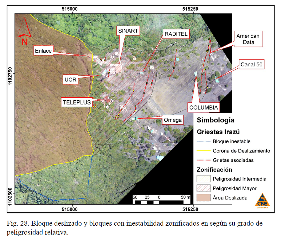
Bloque deslizado y bloques con inestabilidad zonificados en según su grado de peligrosidad relativa.

Sliding block and blocks with instability zoned according to their degree of relative danger

Irazú, Costa Rica, 2020

Figure 28 in: Muller, C., Pacheco, J., Angarita, M., Alvarado, G.E., Sánchez, B. & Avard, G. (2020). El deslizamiento de las Torres del Irazú del 2020 (Costa Rica): antecedentes, colapso y situación actual. OVSICORI-UNA y CNE. Informe Interno.


This map was produced by an official agency, but is NOT the most recent, most complete, or main operational map. For the current operational hazard map, please consult the proper institutional authorities.

If link seems broken, try the archived version.

Map Data

Map ID4040
Hazard Process(es)Debris avalanches
Hazard Zone PresentationSingle hazard: A single hazard process is represented on a main map panel
Temporal ScaleBackground, or long-term, map
Spatial ScalePart of volcano (flank or drainage)
Publication FormatFigure in a hazard assessment or mitigation plan
Zonation Method(s)Geologic history
Zonation Model(s)
Scenario(s) ConsideredCurrent conditions
Hazard Zone Label(s)Qualitative relative probability (e.g. high-medium-low)
Probability Definition(s)Qualitative relative probability (e.g. high-medium-low)
PurposeLand-use planning: Intended to inform citing of facilities, building restrictions, resource management, and infrastructure development
AudienceLand-use planners, city planners, government officials, etc.
Language(s)Spanish
Basemap(s)Photograph
Basemap overlay(s)
DiemsionalityPlanimetric (2D or map) view
Color SchemeSymbols and/or lines only
Go to Global Volcanism Program page for Irazú →