
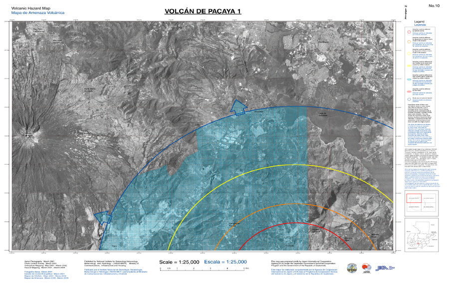
Volcán de Pacaya 1, Mapa de Amenaza Volcánica
Pacaya Volcano 1, Volcanic Hazard Map
Pacaya, Guatemala, 2021
8.2, 1 in: Coordinadora Nacional para la Reducción de Desastres (CONRED), Instituto Nacional de Sismología, Vulcanología, Meteorología e Hidrología (INSIVUMEH), Japan International Cooperation Agency (JICA). (2021). Protocolo Operativo por Actividad Efusiva del Volcán Pacaya. https://conred.gob.gt/documentos/planes/DRE_20210211_01_PROTOCOLO_OPERATIVO_POR_ACTIVIDAD_EFUSIVA_VOLCAN_PACAYA.pdf
This map was produced by an official agency, but may not be the most recent, most complete, or main operational map.
For the current operational hazard map, please consult the proper institutional authorities.
Click on thumbnail for full-size map. We do not have copyright permission to display the full-size image. If you are the copyright holder and wish to provide copyright, please contact us at admin@volcanichazardmaps.org. If link seems broken, try the archived version.
Coordinadora Nacional para la Reducción de Desastres (CONRED). (2021). Protocolo Operativo por Actividad Efusiva del Volcán Pacaya. https://conred.gob.gt/documentos/planes/DRE_20210211_01_PROTOCOLO_OPERATIVO_POR_ACTIVIDAD_EFUSIVA_VOLCAN_PACAYA.pdfMap Set
https://conred.gob.gt/documentos/planes/DRE_20210211_01_PROTOCOLO_OPERATIVO_POR_ACTIVIDAD_EFUSIVA_VOLCAN_PACAYA.pdf
Other Maps In Set: