
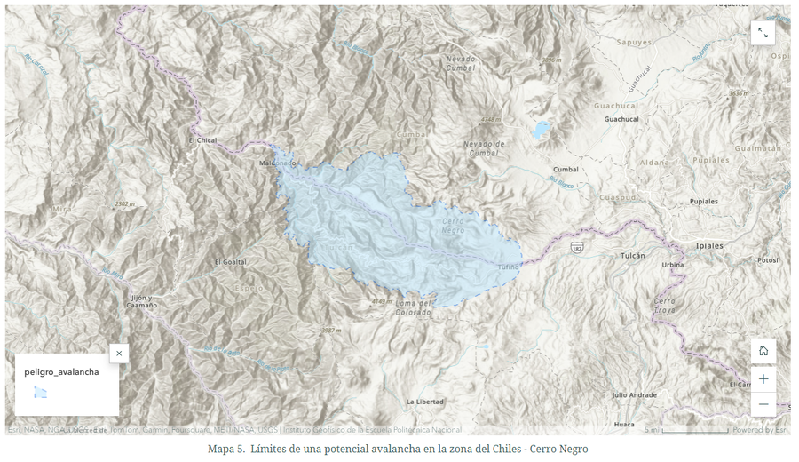
Límites de una potencial avalancha en la zona del Chiles - Cerro Negro
Limits of a potential avalanche in the Chiles - Cerro Negro area
Chiles-Cerro Negro, Colombia-Ecuador, 2024
Map 5 in: Instituto Geofísico de la Escuela Politecnica Nacional (IG-EPN). (2024). Complejo volcánico Chiles - Cerro Negro - Mapa de amenazas potenciales para el complejo Chiles - Cerro Negro. January 24, 2024. https://www.igepn.edu.ec/mapas/amenaza-volcanica/mapa-volcan-ccn.html
This map was produced by an official agency, but may not be the most recent, most complete, or main operational map.
For the current operational hazard map, please consult the proper institutional authorities.
Click on thumbnail for full-size map. We do not have copyright permission to display the full-size image. If you are the copyright holder and wish to provide copyright, please contact us at admin@volcanichazardmaps.org.
Map Set
Instituto Geofísico de la Escuela Politecnica Nacional (IG-EPN). (2024). Complejo volcánico Chiles - Cerro Negro - Mapa de amenazas potenciales para el complejo Chiles - Cerro Negro. January 24, 2024. https://www.igepn.edu.ec/mapas/amenaza-volcanica/mapa-volcan-ccn.html
https://www.igepn.edu.ec/mapas/amenaza-volcanica/mapa-volcan-ccn.html
Other Maps In Set: