
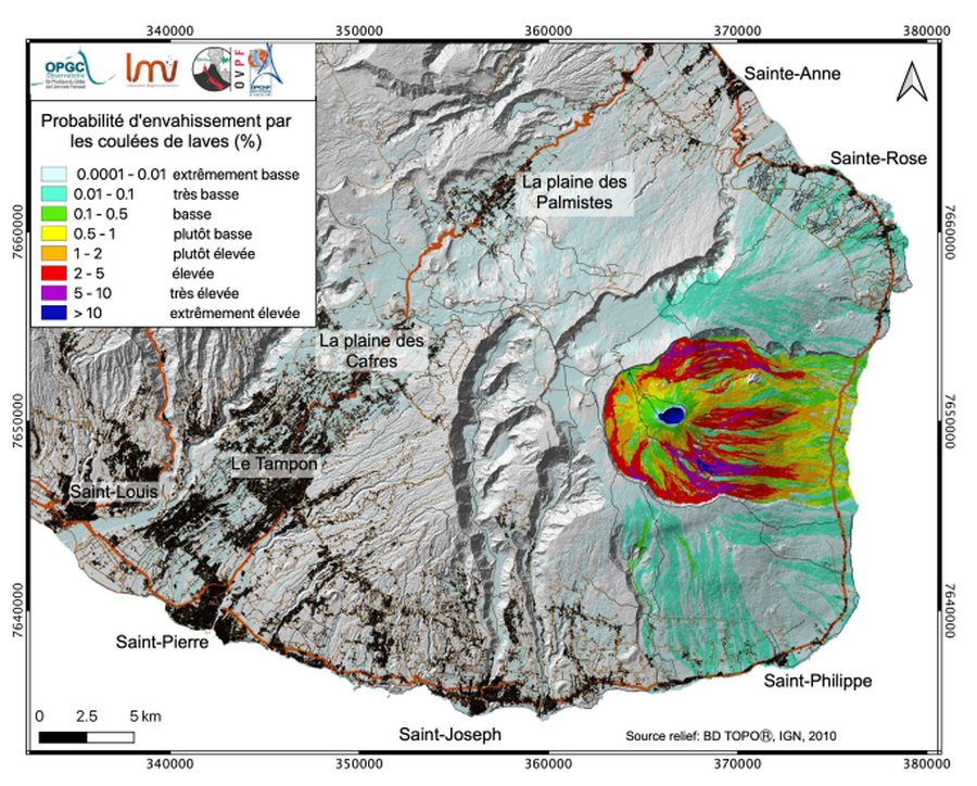
Probabilité d'envahissement par les coulées de laves (%)
Probability of invasion by lava flows (%)
Piton de la Fournaise, Reunion Island [France], 2021
Page 17 in: Préfet de la Région Réunion. (2021). Planification ORSEC, Disposition Spécifique, Volcan Piton de la Fournaise. Etat-Major de Zone et de Protection Civile de l’Océan Indien.
This map was produced by an official agency, but may not be the most recent, most complete, or main operational map.
For the current operational hazard map, please consult the proper institutional authorities.
Click on thumbnail for full-size map. We do not have copyright permission to display the full-size image. If you are the copyright holder and wish to provide copyright, please contact us at admin@volcanichazardmaps.org. If link seems broken, try the archived version.