Lopevi Safety Map
Lopevi, Vanuatu, 2025
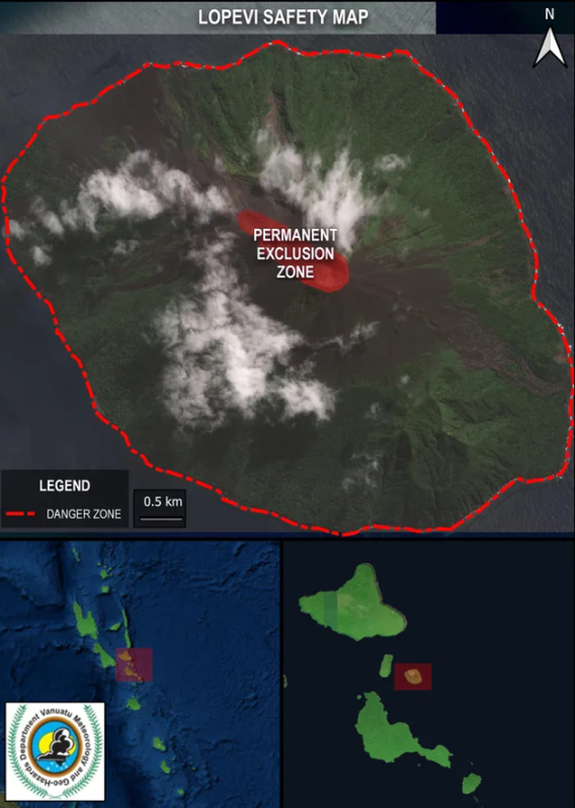
Vanuatu Meteorology & Geo-Hazards Department. (2025). Vanuatu Volcano Alert Bulletin n°03 - Lopevi Activity (Thursday March 27th 2025). Government of Vanuatu, Vanuatu Meteorology & Geo-Hazards Department.
This map was produced by an official agency, but may not be the most recent, most complete, or main operational map.
For the current operational hazard map, please consult the proper institutional authorities.

Click on image for full-size map. If link seems broken, try the archived version.
Map Data
Map ID 4257 Hazard Process(es) Access or danger zone Hazard Zone Presentation Hazard level-focused: All or most hazards are combined by hazard level on a main map and series of insets Temporal Scale Crisis, or short-term, map (hours to decades) Spatial Scale Island Publication Format Part of an information statement, bulletin, or other alert product Zonation Method(s) Geologic history Zonation Model(s) Scenario(s) Considered Current conditions Hazard Zone Label(s) Access (exclusion, danger, or safe zones) Probability Definition(s) No probability definition was discernable from the map Purpose Crisis management and response: Intended to be used for managing, responding to, and taking action during an eruption; often includes evacuation routes, access restrictions, actions to take, etc. Audience General public and/or media Language(s) English Basemap(s) Satellite image Basemap overlay(s) Diemsionality Planimetric (2D or map) view Color Scheme Single color