
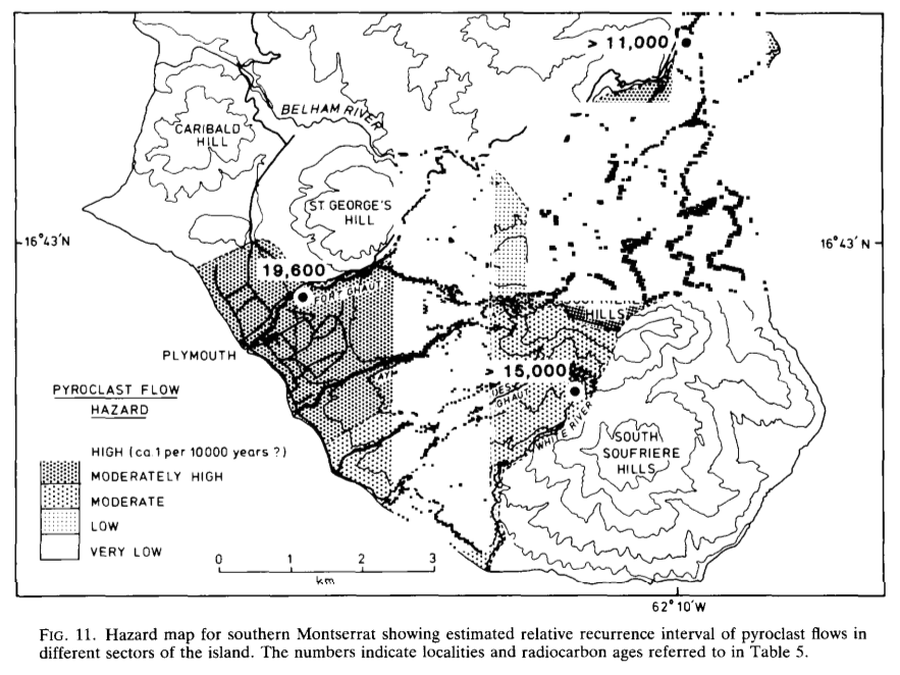
Hazard map for southern Montserrat showing estimated relative recurrence interval of pyroclast flows in different sectors of the island
Soufrière Hills, Montserrat [United Kingdom], 1985
Figure 11 in: Baker, P. E. (1985). Volcanic hazards on St Kitts and Montserrat, West Indies. Journal of the Geological Society 142 (2): 279–295. https://doi.org/10.1144/gsjgs.142.2.0279
This hazard map is the result of scientific research and was published in academic literature.
It is presented here to serve as an example of the map type or the map-making methodology. It is NOT the official, operational map. For the current operational hazard map, please consult the proper institutional authorities.
Click on thumbnail for full-size map. We do not have copyright permission to display the full-size image. If you are the copyright holder and wish to provide copyright, please contact us at admin@volcanichazardmaps.org.
Map Set
Baker, P. E. (1985). Volcanic hazards on St Kitts and Montserrat, West Indies. Journal of the Geological Society 142 (2): 279–295. https://doi.org/10.1144/gsjgs.142.2.0279
https://doi.org/10.1144/gsjgs.142.2.0279
Other Maps In Set: