
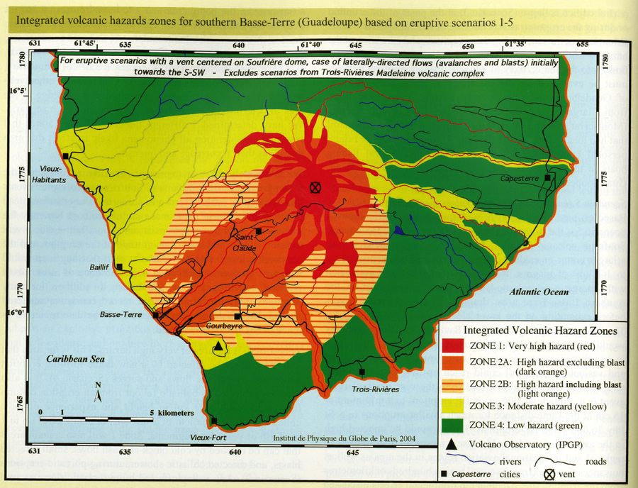
Integrated volcanic hazards zones for southern Basse-Terre (Guadeloupe) based on eruptive scenarios 1-5
Soufrière Guadeloupe, Guadeloupe [France], 2005
Page 98 in: Komorowski, J.-C., Boudon, G., Michel-Semet, Beauducel, F., Anténor-Habazac, C., Bazin, S., & Hammouya, G. (2005). Guadeloupe. In: Lindsay, J.M., Shepherd, J.B., Robertson, R.E.A., & Ali, S. (Eds) Volcanic hazard atlas of the Lesser Antilles. Seismic Research Unit, The University of the West Indies, Trinidad and Tobago, W.I., p. 68-106.
This map was produced by an official agency, but may not be the most recent, most complete, or main operational map.
For the current operational hazard map, please consult the proper institutional authorities.
Click on image for full-size map. If link seems broken, try the archived version.
Komorowski, J.-C., Boudon, G., Michel-Semet, Beauducel, F., Anténor-Habazac, C., Bazin, S., Hammouya, G. (2005). Guadeloupe. In: Lindsay, J.M., Shepherd, J.B., Robertson, R.E.A., & Ali, S. (Eds) Volcanic hazard atlas of the Lesser Antilles. Seismic Research Unit, The University of the West Indies, Trinidad and Tobago, W.I., p. 68-106.Map Set
https://uwiseismic.com/wp-content/uploads/2021/10/Guadeloupe.pdf
Other Maps In Set: