
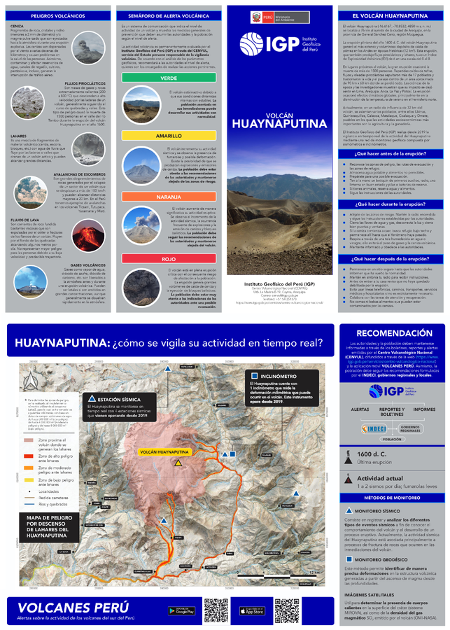
Mapa de Peligro por Descenso de Lahares del Huaynaputina
Hazard Map for Lahar Descent at Huaynaputina
Huaynaputina, Peru, 2022
Instituto Geofísico del Perú. (2022). Cuadríptico informativo del volcán Huaynaputina. Pósters. Instituto Geofísico del Perú. http://hdl.handle.net/20.500.12816/5158
This map was produced by an official agency, but may not be the most recent, most complete, or main operational map.
For the current operational hazard map, please consult the proper institutional authorities.
Click on image for full-size map. If link seems broken, try the archived version.
Map Data
Map ID 4323 Hazard Process(es) Lahars Hazard Zone Presentation Single hazard: A single hazard process is represented on a main map panel Temporal Scale Background, or long-term, map Spatial Scale Volcano and surrounding area Publication Format Flyer, brochure, short fact-sheet, infographic, or handout Zonation Method(s) Scenario modeling Zonation Model(s) LAHARZ or modified version (such as PFZ) (Iverson et al. 1998; Schilling 1998; Schilling 2014) Scenario(s) Considered Size, VEI, or intensity Hazard Zone Label(s) Location or source name; Qualitative relative probability (e.g. high-medium-low) Probability Definition(s) Qualitative relative probability (e.g. high-medium-low) Purpose Hazard awareness: Intended for educating the audience about the extent and probability of volcanic hazard Audience General public and/or media Language(s) Spanish Basemap(s) Satellite image Basemap overlay(s) Station map; Street map Diemsionality Planimetric (2D or map) view Color Scheme Red to Yellow Volcanic Alert Level System https://global-valid.org/val-peru-27/