
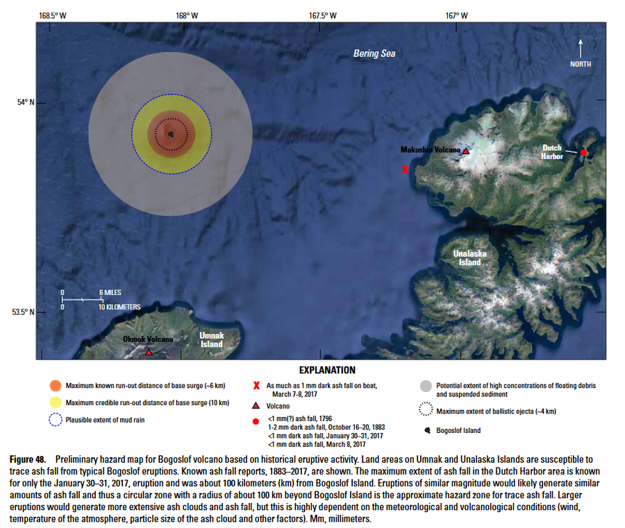
Preliminary hazard map for Bogoslof volcano based on historical eruptive activity
Bogoslof, United States, 2018
Figure 48 in: Waythomas, C. F., & Cameron, C. E. (2018). Historical eruptions and hazards at Bogoslof volcano, Alaska (No. 2018-5085). US Geological Survey. Scientific Investigations Report, 2018-5085. https://doi.org/10.3133/sir20185085
This map was produced by an official agency, but may not be the most recent, most complete, or main operational map.
For the current operational hazard map, please consult the proper institutional authorities.
Click on image for full-size map. If link seems broken, try the archived version.