
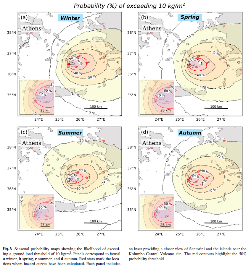
Seasonal probability maps showing the likelihood of exceeding a ground load threshold of 10 kg/m²
Kolumbo, Greece, 2025
Figure 8 in: Pardini, F., Bevilacqua, A., Cerminara, M., Vitturi, M. D. M., Tadini, A., Neri, A., ... & Vougioukalakis, G. (2025). Explosive eruptions of Kolumbo Central Volcano and associated tephra fallout hazards assessment. Bulletin of Volcanology, 87(12), 116. https://doi.org/10.1007/s00445-025-01907-z
This hazard map is the result of scientific research and was published in academic literature.
It is presented here to serve as an example of the map type or the map-making methodology. It is NOT the official, operational map. For the current operational hazard map, please consult the proper institutional authorities.
Click on image for full-size map.
Map Set
Pardini, F., Bevilacqua, A., Cerminara, M., Vitturi, M. D. M., Tadini, A., Neri, A., ... & Vougioukalakis, G. (2025). Explosive eruptions of Kolumbo Central Volcano and associated tephra fallout hazards assessment. Bulletin of Volcanology, 87(12), 116. https://doi.org/10.1007/s00445-025-01907-z
https://doi.org/10.1007/s00445-025-01907-z
Other Maps In Set: