
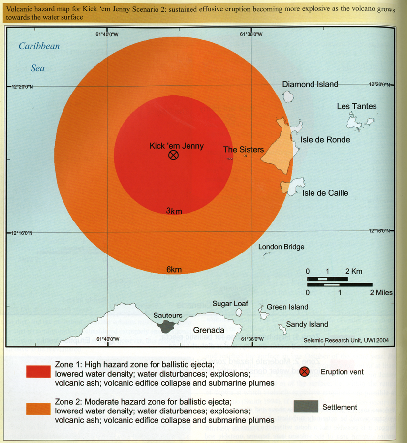
Volcanic hazard map for Kick 'em Jenny Scenario 2: sustained effusive eruption becoming more explosive as the volcano grows towards the water surface
Kick 'em Jenny, Grenada, 2005
Page 122 in: Lindsay, J.M. & Shepherd, J.B. (2005). Kick’em Jenny and Ile de Caille. In: Lindsay, J.M., Shepherd, J.B., Robertson, R.E.A., & Ali, S. (Eds) Volcanic hazard atlas of the Lesser Antilles. Seismic Research Unit, The University of the West Indies, Trinidad and Tobago, W.I., p. 105-125.
This map was produced by an official agency, but is NOT the most recent, most complete, or main operational map.
For the current operational hazard map, please consult the proper institutional authorities.
Click on image for full-size map. If link seems broken, try the archived version.
Lindsay, J.M. & Shepherd, J.B. (2005). Kick’em Jenny and Ile de Caille. In: Lindsay, J.M., Shepherd, J.B., Robertson, R.E.A., & Ali, S. (Eds) Volcanic hazard atlas of the Lesser Antilles. Seismic Research Unit, The University of the West Indies, Trinidad and Tobago, W.I., p. 108-125.Map Set
https://uwiseismic.com/wp-content/uploads/2021/10/Kick-em-Jenny.pdf
Other Maps In Set: