
Mapa Participativo Frente al Riesgo Volcánico. Murillo - Líbano - Villahermosa, Tolima.
Participatory Map of Volcanic Risk: Murillo – Líbano – Villahermosa, Tolima
Nevado del Ruiz, Colombia, 2018
Uribe Orozco, L., Bedoya Vallejo, D., Rudas, J.G., Arenas Giraldo, A.J., Virgilio Daza, J., Giraldo, A., Mancipe, J., Loaiza, M.G., Enerli Quintero, J., Martínez, H., Segura Pineda, J.F., Arenas, F., Barajas, M., Yamel Rueda, H., Arango Muñoz, A., Rivera., M.T. (2018). Mapa Participativo Frente al Riesgo Volcánico. Murillo - Líbano - Villahermosa, Tolima. Volcánico Volcán, Riesgo, y Territorio. UNGRD, SGC, OCyT.
This map may not be the most recent, most complete, or main operational map.
For the current operational hazard map, please consult the proper institutional authorities.
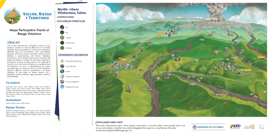
Click on image for full-size map. If link seems broken, try the archived version.
Volcán Riesgo y Territorio. (2018). Mapas participativos frente al riesgo volcánico. UNGRD, SGC, OCYT. https://volcanescolombia.com.co/index.php/caja-de-herramientas-aw#participativo-volcanicoMap Set
https://volcanescolombia.com.co/index.php/caja-de-herramientas-aw#participativo-volcanico
Other Maps In Set: