
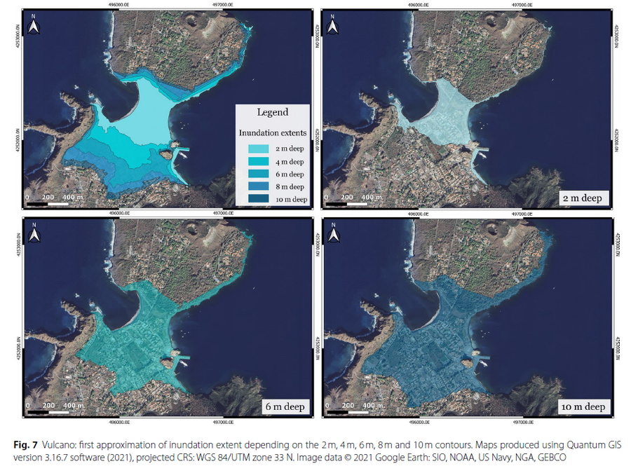
Vulcano: first approximation of inundation extent depending on the 2 m, 4 m, 6 m, 8 m and 10 m contours.
Vulcano, Italy, 2026
Figure 7 in: Bonilauri, E. M., & Harris, A. J. (2026). Tsunami evacuation times and routes to safe zones II: a GIS-based approach applied to Vulcano and Lipari (Aeolian Islands, Italy) to assess escape route challenges for low-lying harbour areas. Journal of Applied Volcanology, 15(1), 5.
This hazard map is the result of scientific research and was published in academic literature.
It is presented here to serve as an example of the map type or the map-making methodology. It is NOT the official, operational map. For the current operational hazard map, please consult the proper institutional authorities.
Click on image for full-size map. If link seems broken, try the archived version.