
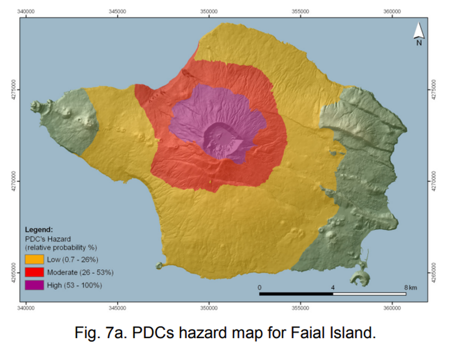
PDCs hazard map for Faial Island
Faial (Fayal), Azores [Portugal], 2009
Figure 7a in: Pimentel, A., Pacheco, J. M., & Self, S. (2009). Numerical Hazard Zonation for Pyroclastic Density Current Scenarios, at Faial and Terceira Islands (Azores). EGU General Assembly, 11, EGU2009-13196 https://www.egu.eu/media/awards/union-osp-award/2009/adriano_pimentel.pdf
This hazard map is the result of scientific research and was published in academic literature.
It is presented here to serve as an example of the map type or the map-making methodology. It is NOT the official, operational map. For the current operational hazard map, please consult the proper institutional authorities.
Click on thumbnail for full-size map. We do not have copyright permission to display the full-size image. If you are the copyright holder and wish to provide copyright, please contact us at admin@volcanichazardmaps.org. If link seems broken, try the archived version.
Pimentel, a., Pacheco, J. M., & Self, S. (2009). Numerical Hazard Zonation for Pyroclastic Density Current Scenarios, at Faial and Terceira Islands (Azores). EGU General Assembly, 11, EGU2009-13196 https://www.egu.eu/media/awards/union-osp-award/2009/adriano_pimentel.pdfMap Set
https://www.egu.eu/media/awards/union-osp-award/2009/adriano_pimentel.pdf
Other Maps In Set: