
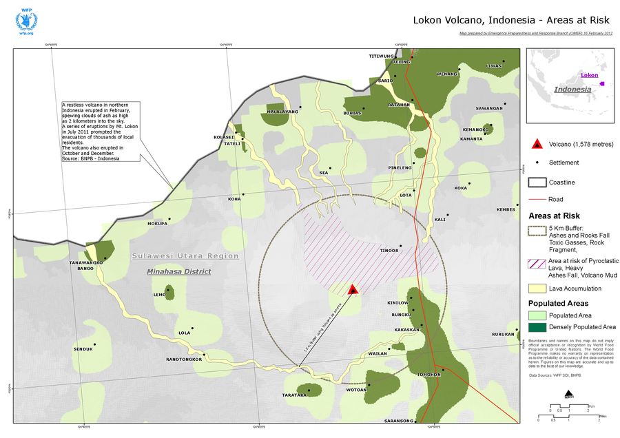
Lokon Volcano, Indonesia - Areas at Risk
Lokon-Empung, Indonesia, 2012
World Food Programme. (2012). Lokon Volcano, Indonesia - Areas at Risk. World Food Prgramme, Emergency Preparedness an Response Branch (OMEP).
This hazard map was created for the situational awareness of an international agency.
This map is presented here to serve as an example of this map type. It is NOT the official, operational map. For the current operational hazard map, please consult the proper institutional authorities.
Click on image for full-size map. If link seems broken, try the archived version.