
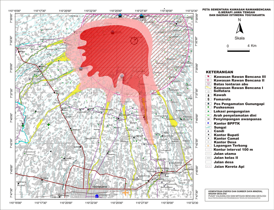
Peta Sementara Kawasan Rawanbencana G. Merapi Jawa Tengah Dan Daerah Istimewa Yogyakarta
Temporary Map of the Disaster-Prone Areas of Mount Merapi, Central Java and the Special Region of Yogyakarta
Merapi, Indonesia, 2010
Badan Geologi - Kementerian Energi Dan Sumber Daya Mineral Badan Geologi, Pusat Vulkanologi Dan Mitigasi Bencana Geologi (PVMBG), Balai Penyelidikan Dan Pengembangan Teknologi Kegunungapian (BPPTK). (2010). Peta Sementara Kawasan Rawanbencana G. Merapi Jawa Tengah Dan Daerah Istimewa Yogyakarta.
This map was produced by an official agency, but is NOT the most recent, most complete, or main operational map.
For the current operational hazard map, please consult the proper institutional authorities.
Click on thumbnail for full-size map. We do not have copyright permission to display the full-size image. If you are the copyright holder and wish to provide copyright, please contact us at admin@volcanichazardmaps.org. If link seems broken, try the archived version.