
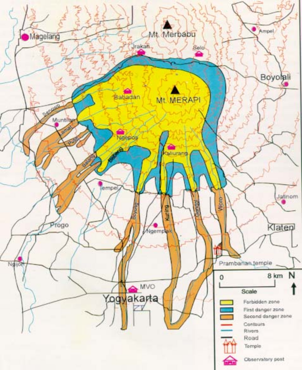
Hazard Map of Merapi
Merapi, Indonesia, 1996
Purbawinata, M. A., Ratdomopurbo, A., Sinulingga, I. K., Sumarti, S., & Suharno, I. (1996). Merapi volcano – guide book. Volcanological Survey of Indonesia (VSI), Bandung. (Reprinted in: Gerstenecker, C., Läufer, G., Steineck, D., Tiede, C., & Wrobel, B. (2005). Validation of digital elevation models around Merapi Volcano, Java, Indonesia. Natural Hazards and Earth System Sciences, 5(6), 863-876. https://doi.org/10.5194/nhess-5-863-2005)
This map was produced by an official agency, but is NOT the most recent, most complete, or main operational map.
For the current operational hazard map, please consult the proper institutional authorities.
Click on image for full-size map. If link seems broken, try the archived version.