
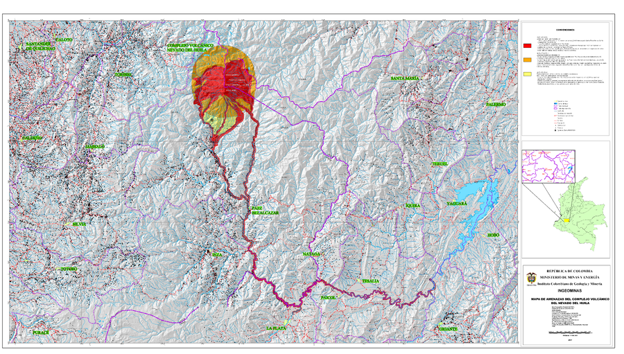
Mapa de Amenazas del Complejo Volcánico del Nevado del Huila
Nevado del Huila Volcanic Complex Hazard Map
Nevado del Huila, Colombia, 2007
Instituto Colombiano de Geología y Minería (INGEOMINAS). (2007). Mapa de Amenazas del Complejo Volcánico del Nevado del Huila. escala 1:100,000.
This map was produced by an official agency, but may not be the most recent, most complete, or main operational map.
For the current operational hazard map, please consult the proper institutional authorities.
Click on image for full-size map. If link seems broken, try the archived version.