
Lahar Hazard Zonation for San Miguel Volcano, El Salvador
San Miguel, El Salvador, 2001
Plate 1 in: Major, J.J., Schilling, S.P., Pullinger, C.R., Escobar, C.D., Chesner, C.A., & Howell, M.M. (2001). Lahar-Hazard Zonation for San Miguel Volcano, El Salvador. U.S. Geological Survey, Open-File Report 2001-395, 16 p., 1 plate. https://doi.org/10.3133/ofr01395
This map was produced by an official agency of a foreign government, but is NOT the most recent, most complete, or main operational map.
For the current operational hazard map, please consult the proper institutional authorities.
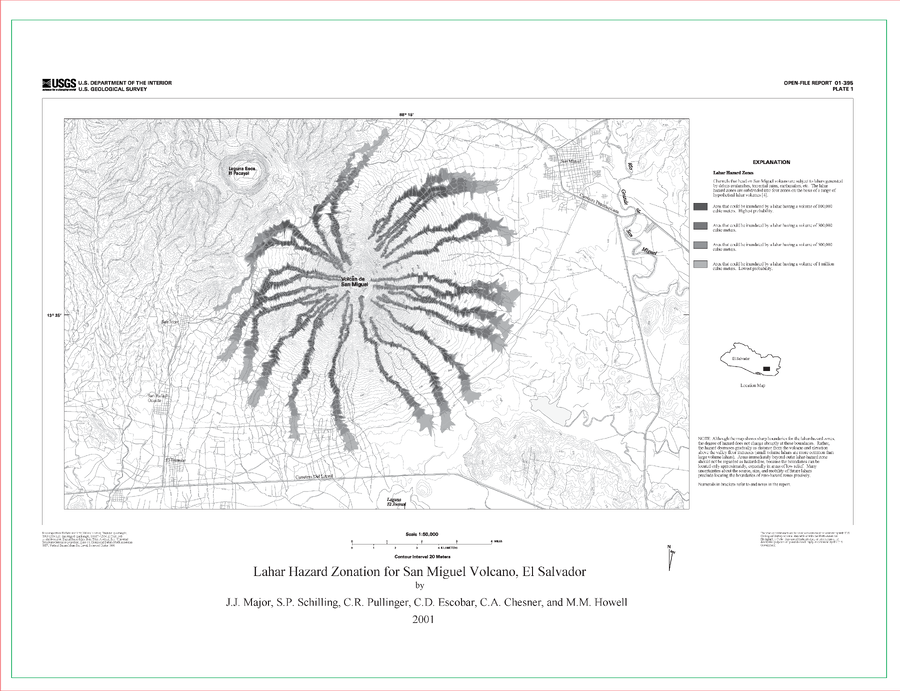
Click on image for full-size map. If link seems broken, try the archived version.