
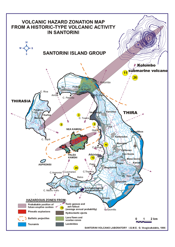
Volcanic Hazard Zonation Map From a Historic-Type Volcanic Activity in Santorini
Santorini, Greece, 1996
Figure 7 in: Vougioukalakis, G.E. (1996). Volcanic Hazard Zonation Map From a Historic-Type Volcanic Activity in Santorini. https://www.santorini.net/wp-content/uploads/Volcanic_Hazard_Zonation_Map.pdf. (Reprinted in: Vougioukalakis, G.E., & Fytikas, M. (2005). Volcanic hazards in the Aegean area, relative risk evaluation, monitoring and present state of the active volcanic centers. In: Fytikas, M. and Vougioukalakis, G. (Eds.) Developments in Volcanology, Vol. 7, p. 161-183, Elsevier. https://doi.org/10.1016/S1871-644X(05)80037-3)
This map was produced by an official agency, but is NOT the most recent, most complete, or main operational map.
For the current operational hazard map, please consult the proper institutional authorities.
Click on thumbnail for full-size map. We do not have copyright permission to display the full-size image. If you are the copyright holder and wish to provide copyright, please contact us at admin@volcanichazardmaps.org. If link seems broken, try the archived version.