
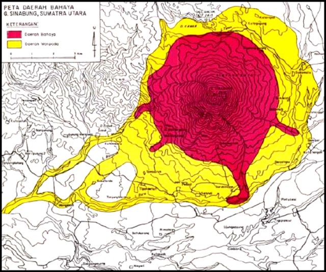
Peta Daerah Bamaya G. Sinabung, Sumatra Utara
Map of the Danger Area G. Sinabung, North Sumatra
Sinabung, Indonesia, Year unknown
Center for Volcanology and Geological Hazard Mitigation (CVGHM). (Year Unknown). Peta Daerah Bamaya G. Sinabung, Sumatra Utara. Reprinted in: Global Volcanism Program. (2010). Report on Sinabung (Indonesia) (Wunderman, R., ed.). Bulletin of the Global Volcanism Network, 35:7. Smithsonian Institution. https://doi.org/10.5479/si.GVP.BGVN201007-261080
This map was produced by an official agency, but is NOT the most recent, most complete, or main operational map.
For the current operational hazard map, please consult the proper institutional authorities.
Click on image for full-size map. If link seems broken, try the archived version.