
Volcanic hazard map of Tenerife (Canary Islands)
Tenerife, Spain, 2008
Paris, R. (2008). Volcanic hazard map of Tenerife (Canary Islands). Geolab UMR 6042 CNRS, CSIC
This map was produced by an official agency, but is NOT the most recent, most complete, or main operational map.
For the current operational hazard map, please consult the proper institutional authorities.
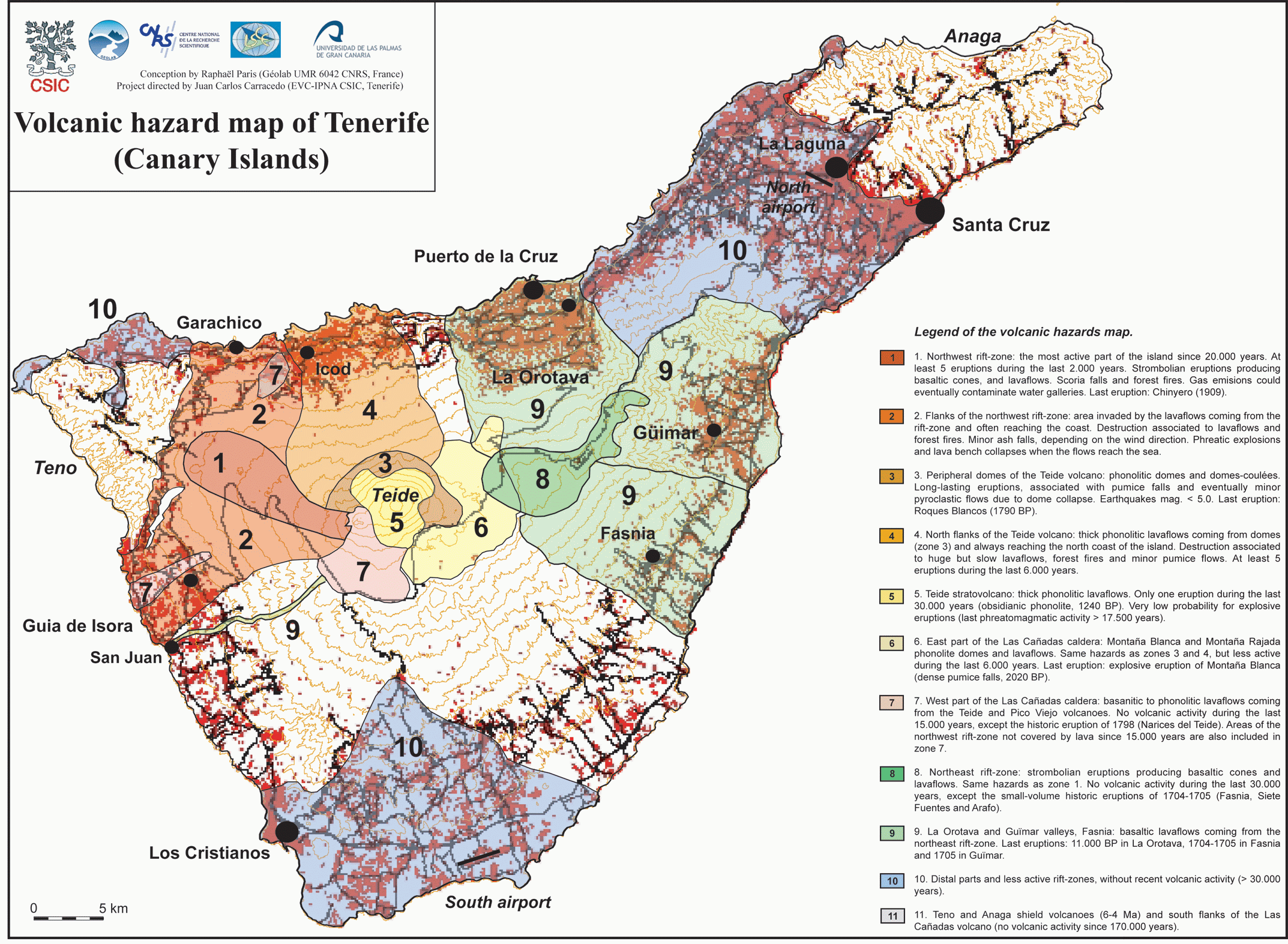
Click on image for full-size map. If link seems broken, try the archived version.