
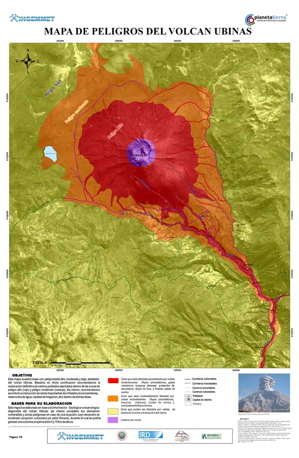
Mapa de Peligros del Volcán Ubinas
Ubinas, Peru, 2006
Instituto Geológico Minero y Metalúrgico (INGEMMET). (2006). Mapa de Peligros del Volcán Ubinas. Instituto Geologico Minero y Metalurgico (INGEMMET), Institut de Recherche pour le Développement (IRD), & Laboratoire Magmas et Volcans.
This map was produced by an official agency, but is NOT the most recent, most complete, or main operational map.
For the current operational hazard map, please consult the proper institutional authorities.
Click on image for full-size map. If link seems broken, try the archived version.
Rivera, M., Thouret, J. C., Mariño, J., Berolatti, R., & Fuentes, J. (2010). Characteristics and management of the 2006–2008 volcanic crisis at the Ubinas volcano (Peru). Journal of Volcanology and Geothermal Research, 198(1-2), p. 19-34. https://doi.org/10.1016/j.jvolgeores.2010.07.020Map Set
https://doi.org/10.1016/j.jvolgeores.2010.07.020
Other Maps In Set: