
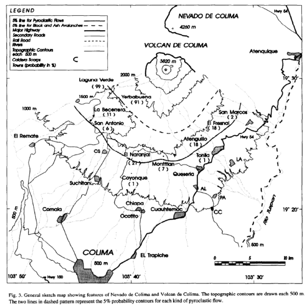
General sketch map showing features of Nevado de Colima and Volcan de Colima
Colima, Mexico, 1995
Figure 3 in: Sheridan, M.F., & Macías, J. (1995). Estimation of risk probability for gravity-driven pyroclastic flows at Volcan Colima, Mexico. Journal of Volcanology and Geothermal Research, 66(1-4), p. 251-256. https://doi.org/10.1016/0377-0273(94)00058-O
This hazard map is the result of scientific research and was published in academic literature.
It is presented here to serve as an example of the map type or the map-making methodology. It is NOT the official, operational map. For the current operational hazard map, please consult the proper institutional authorities.
Click on thumbnail for full-size map. We do not have copyright permission to display the full-size image. If you are the copyright holder and wish to provide copyright, please contact us at admin@volcanichazardmaps.org.