
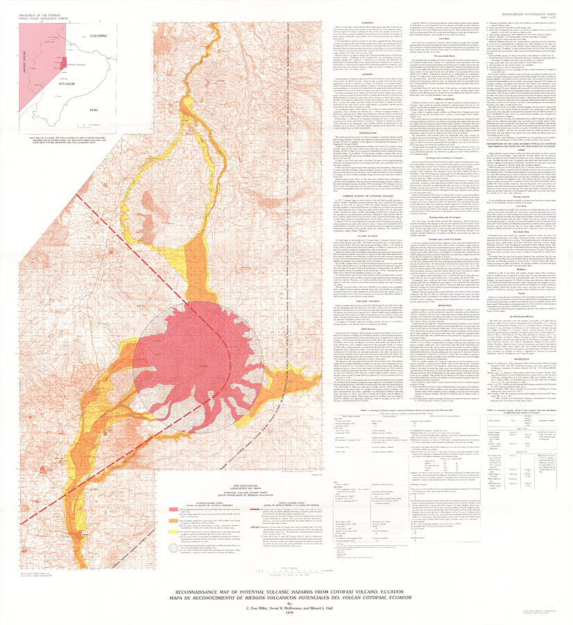
Reconnaissance Map of Potential Volcanic Hazards from Cotopaxi Volcano, Ecuador. Mapa de Reconocimiento de Riesgos Volganicos Potenciales Del Volcan Cotopaxi, Ecuador.
Cotopaxi, Ecuador, 1978
Plate 1 in: Miller, C.D., Mullineaux, D.R., & Hall, M.L. (1978). Reconnaissance Map of Potential Volcanic Hazards from Cotopaxi Volcano, Ecuador. Mapa de Reconocimiento de Riesgos Volganicos Potenciales Del Volcan Cotopaxi, Ecuador. U.S. Geological Survey, IMAP 1072. https://doi.org/10.3133/i1072
This map was produced by an official agency of a foreign government, but is NOT the most recent, most complete, or main operational map.
For the current operational hazard map, please consult the proper institutional authorities.
Click on image for full-size map. If link seems broken, try the archived version.