
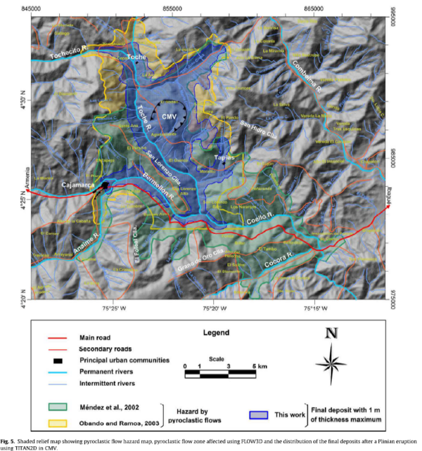
Shaded relief map showing pyroclastic flow hazard map, pyroclastic flow zone affected using FLOW3D and the distribution of the final deposits after a Plinian eruption using TITAN2D in CMV.
Machín, Colombia, 2010
Figure 5 in: Murcia, H.F., Sheridan, M.F., Macías, J.L., & Cortés, G.P. (2010). TITAN2D simulations of pyroclastic flows at Cerro Machín Volcano, Colombia: Hazard implications. Journal of South American Earth Sciences, 29(2), p. 161-170. https://doi.org/10.1016/j.jsames.2009.09.005
This hazard map is the result of scientific research and was published in academic literature.
It is presented here to serve as an example of the map type or the map-making methodology. It is NOT the official, operational map. For the current operational hazard map, please consult the proper institutional authorities.
Click on thumbnail for full-size map. We do not have copyright permission to display the full-size image. If you are the copyright holder and wish to provide copyright, please contact us at admin@volcanichazardmaps.org.
Map Set
Murcia, H.F., Sheridan, M.F., Macías, J.L., & Cortés, G.P. (2010). TITAN2D simulations of pyroclastic flows at Cerro Machín Volcano, Colombia: Hazard implications. Journal of South American Earth Sciences, 29(2), p. 161-170. https://doi.org/10.1016/j.jsames.2009.09.005
https://doi.org/10.1016/j.jsames.2009.09.005