
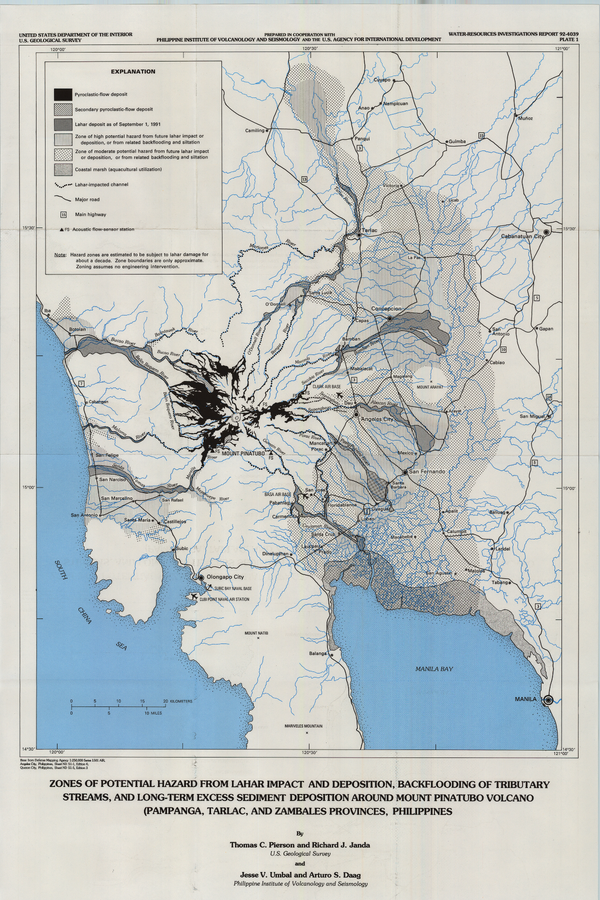
Zones of Potential Hazard from Lahar Impact and Deposition, Backflooding of Tributary Streams, and Long-Term Excess Sediment Deposition Around Mount Pinatubo Volcano (Pampanga, Tarlac, and Zambales Provinces, Philippines)
Pinatubo, Philippines, 1992
Plate 1 in: Pierson, T.C., Janda, R.J., Umbal, J.V., & Daag, A.S. (1992). Immediate and long-term hazards from lahars and excess sedimentation in rivers draining Mount Pinatubo, Philippines. U.S. Geological Survey, Water-Resources Investigations Report 92-4039, 35 p., 1 plate. https://doi.org/10.3133/wri924039
This map was produced by an official agency of a foreign government, but is NOT the most recent, most complete, or main operational map.
For the current operational hazard map, please consult the proper institutional authorities.
Click on image for full-size map. If link seems broken, try the archived version.