
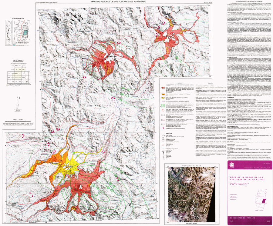
Mapa de Peligros de los Volcanes del Alto Biobio
Hazards Map of the Alto Biobio Volcanoes
Alto Biobio (Callaqui, Copahue, Lonquimay, & Tolguaca), Chile, Chile-Argentina, 2000
Naranjo, J. A., Moreno, H., Polanco, E., & Young, S. (2000). Mapa de Peligros de los Volcanes del Alto Biobio, Regiones del Biobio y La Araucania. Servicio Nacional de Geología y Minería (SERNAGEOMIN), Documentos de Trabajo No. 15, 1 mapa escala 1:100000. Santiago.
This map was produced by an official agency, but may not be the most recent, most complete, or main operational map.
For the current operational hazard map, please consult the proper institutional authorities.
Click on image for full-size map. If link seems broken, try the archived version.