
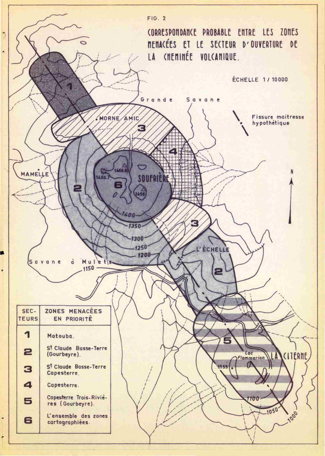
Correspondance Probable Entre les Zones Menacées et le Secteur d'Ouverture de la Cheminée Volcanique
Probable Correspondence Between the Endangered Zones and the Opening Sector of the Volcanic Chimney
Soufrière Guadeloupe, Guadeloupe [France], 1976
Figure 2 in: Westercamp, D. (1976). Dynamismes Éruptifs et Zonation des Risques Volcaniques a la Sourfrière de Guadeloupe. Bureau de Recherches Géologiques, Service Geologique des Antilles.
This map was produced by an official agency, but is NOT the most recent, most complete, or main operational map.
For the current operational hazard map, please consult the proper institutional authorities.
Click on image for full-size map. If link seems broken, try the archived version.
Westercamp, D. (1976). Dynamismes Éruptifs et Zonation des Risques Volcaniques a la Sourfrière de Guadeloupe. Bureau de Recherches Géologiques, Service Geologique des Antilles.Map Set
http://infoterre.brgm.fr/rapports/76-ANT-026.pdf
Other Maps In Set: