← Back to Search Results

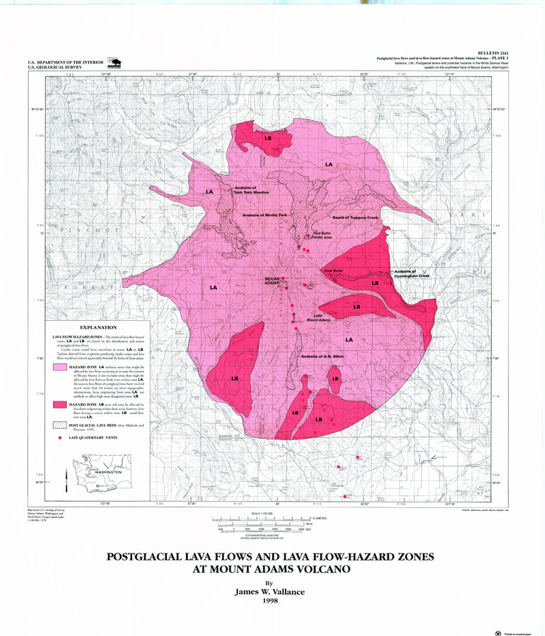
Postglacial Lava Flows and Lava Flow-Hazard Zones at Mount Adams Volcano

Adams, United States, 1998

Plate 1 in: Vallance, J.W. (1999). Postglacial lahars and potential hazards in the White Salmon River system on the southwest flank of Mount Adams, Washington. U.S. Geological Survey, Bulletin 2161, 49 p., 2 plates. https://doi.org/10.3133/b2161


This map was produced by an official agency, but may not be the most recent, most complete, or main operational map. For the current operational hazard map, please consult the proper institutional authorities.


Click on image for full-size map. If link seems broken, try the archived version.

Map Set

Vallance, J.W. (1999). Postglacial lahars and potential hazards in the White Salmon River system on the southwest flank of Mount Adams, Washington. U.S. Geological Survey, Bulletin 2161, 49 p., 2 plates. https://doi.org/10.3133/b2161
https://doi.org/10.3133/b2161

Other Maps In Set:

Map Data

Map ID605
Hazard Process(es)Lava flows; Tephra fall; Vent-opening hazards
Hazard Zone PresentationSingle hazard: A single hazard process is represented on a main map panel
Temporal ScaleBackground, or long-term, map
Spatial ScaleVolcano and surrounding area
Publication FormatPoster-style map insert in hazard assessment
Zonation Method(s)Geologic history
Zonation Model(s)
Scenario(s) ConsideredSource location or direction
Hazard Zone Label(s)Location or source name
Probability Definition(s)Qualitative relative probability (e.g. high-medium-low)
PurposeMultiple: intended for multiple purposes including general hazard awareness, planning, and crisis management
AudienceMultiple audiences (usually the public, civil authorities, and land-use planners)
Language(s)English
Basemap(s)Contour lines
Basemap overlay(s)Street map
DiemsionalityPlanimetric (2D or map) view
Color SchemeDark to Light (color)
Go to Global Volcanism Program page for Adams →