
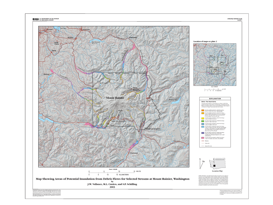
Map Showing Areas of Potential Inundation from Debris Flows for Selected Streams at Mount Rainier, Washington
Rainier, United States, 2003
Plate 1 in: Vallance, J.W., Cunico, M.L. & Schilling, S.P. (2003). Debris-flow hazards caused by hydrologic events at Mount Rainier, Washington. U.S. Geological Survey, Open-File Report 03-368, 4 p., 2 plates. https://doi.org/10.3133/ofr03368
This map was produced by an official agency, but may not be the most recent, most complete, or main operational map.
For the current operational hazard map, please consult the proper institutional authorities.
Click on image for full-size map. If link seems broken, try the archived version.
Vallance, J.W., Cunico, M.L. & Schilling, S.P. (2003). Debris-flow hazards caused by hydrologic events at Mount Rainier, Washington. U.S. Geological Survey, Open-File Report 03-368, 4 p., 2 plates. https://doi.org/10.3133/ofr03368Map Set
https://doi.org/10.3133/ofr03368
Other Maps In Set: