← Back to Search Results

Levels of Volcanic Risk Near Mount St. Helens

St. Helens, United States, 1984

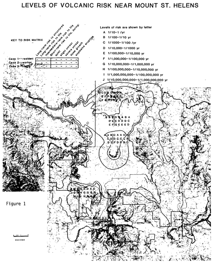
Figure 1 in: Newhall, C.G. (1984). Semi-quantitative assessment of changing volcanic risk at Mount St. Helens, Washington. U.S. Geological Survey, Open-File Report 84-272, 30 p. doi:10.3133/ofr84272


This map was produced by an official agency, but is NOT the most recent, most complete, or main operational map. For the current operational hazard map, please consult the proper institutional authorities.


Click on image for full-size map. If link seems broken, try the archived version.

Map Data

Map ID618
Hazard Process(es)Unstated or all hazards
Hazard Zone PresentationHazard level-focused: All or most hazards are combined by hazard level on a main map panel
Temporal ScaleVery short-term crisis map (hours to days)
Spatial ScaleVolcano and surrounding area
Publication FormatFigure in a hazard assessment or mitigation plan
Zonation Method(s)Event tree
Zonation Model(s)
Scenario(s) ConsideredCurrent conditions; Specific past eruption
Hazard Zone Label(s)Numeric probability
Probability Definition(s)Annual numeric probability
PurposeScientific interest: Intended for scientific research and general scientific interest; usually published in academic journals
AudienceScientists (usually in scientific publication)
Language(s)English
Basemap(s)Contour lines
Basemap overlay(s)
DiemsionalityPlanimetric (2D or map) view
Color SchemeSymbols and/or lines only
Go to Global Volcanism Program page for St. Helens →