
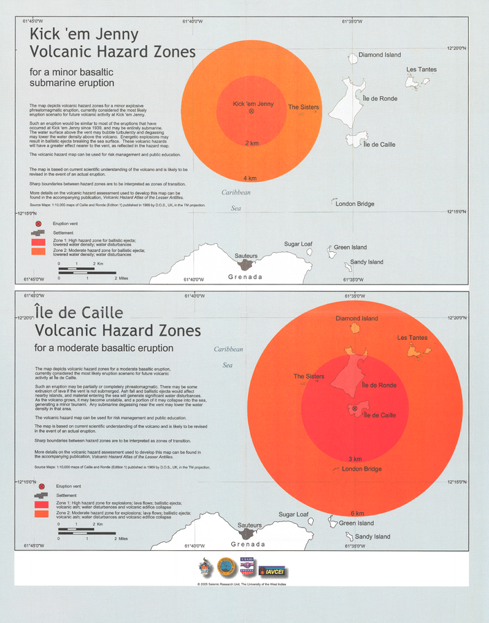
Kick 'em Jenny Volcanic Hazard Zones for a minor basaltic submarine eruption & Île de Caille Volcanic Hazard Zones for a moderate basaltic eruption
Île de Caille & Kick 'em Jenny, Grenada, 2005
Pocket insert in: Lindsay, J.M. & Shepherd, J.B. (2005). Kick’em Jenny and Ile de Caille. In: Lindsay, J.M., Shepherd, J.B., Robertson, R.E.A., & Ali, S. (Eds) Volcanic hazard atlas of the Lesser Antilles. Seismic Research Unit, The University of the West Indies, Trinidad and Tobago, W.I., p. 105-125.
This map was produced by an official agency, but is NOT the most recent, most complete, or main operational map.
For the current operational hazard map, please consult the proper institutional authorities.
Map Set
Lindsay, J.M. & Shepherd, J.B. (2005). Kick’em Jenny and Ile de Caille. In: Lindsay, J.M., Shepherd, J.B., Robertson, R.E.A., & Ali, S. (Eds) Volcanic hazard atlas of the Lesser Antilles. Seismic Research Unit, The University of the West Indies, Trinidad and Tobago, W.I., p. 108-125.
https://uwiseismic.com/wp-content/uploads/2021/10/Kick-em-Jenny.pdf
Other Maps In Set:
- Volcanic hazard map for a phreatomagmatic eruption at Ile de Caille
- Volcanic hazard map for Kick 'em Jenny, Scenario 1: short-lived phreatomagmatic eruption at the current depth to vent of 267m
- Volcanic hazard map for Kick 'em Jenny Scenario 2: sustained effusive eruption becoming more explosive as the volcano grows towards the water surface